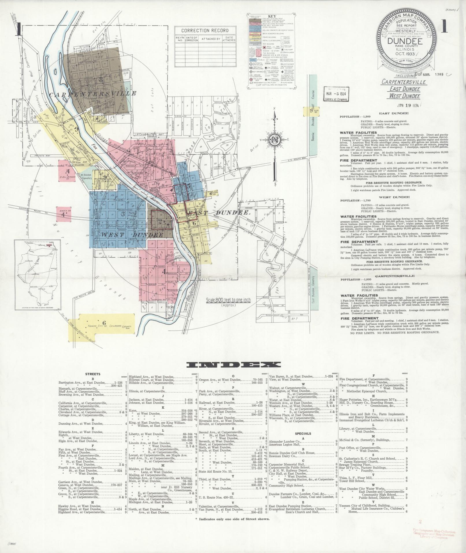
What It Shows
Sanborn maps were produced for fire insurance underwriters and capture building-level detail unavailable in any other historical source of this period:
- Building footprints with construction material noted by color code (brick, frame, stone, etc.)
- Building use — residential, commercial, industrial, storage, livery, etc.
- Number of stories
- Roof type and skylights (relevant for fire spread)
- Locations of fire hydrants, cisterns, and hose connections
- Street names and widths
- Block and lot numbers
Why It Matters
The 1933 Sanborn is one of only two digitized Sanborn surveys of the Dundee area held at the Library of Congress (the other is a 1940 update edition). For The Kiln's purposes, this map is the primary tool for:
- Locating where the original five licensed saloons (1887) operated along Main Street
- Identifying the Engine House purchased in October 1887 for $150 from Henry Edwards (used as the first civic meeting space and polling place)
- Tracing the footprint of the Dundee Electric Light Company and other early franchise infrastructure
- Anchoring the Board of Local Improvements street-improvement projects (Elgin Avenue, etc.) to specific block-level geography
- Identifying any surviving structure from the 1887–1895 founding era documented in the village record books
- Locating the millrace associated with the Chris Patsche property noted in Board of Local Improvements records
A second Sanborn survey (also digitized at LOC, item `sanborn01831_007`) was produced October 1933 – May 1940, with 9–10 sheets. It represents updates to the 1933 base map and allows comparison for buildings constructed or demolished in the 1930s. Both editions should be consulted together for research.
Access
Both editions are freely available online through the Library of Congress:
- 1933 edition (9 sheets): loc.gov/item/sanborn01831_006
- 1940 update (9–10 sheets): loc.gov/item/sanborn01831_007
Sheet 6 (East Dundee) is now self-hosted (see `scans` above), independently confirmed against a scan collected by a resident. It shows the East Dundee blocks along Jackson, Higgins (Main), Johnson, and Maiden Lane, with Haeger Potteries Inc., Tower Hill School (a private school for boys), and the Yeomen Mutual Life Insurance Co. Children's Home individually labeled by footprint. Sheets 2–5 and 7–9 are still only reachable via the LOC links above and will break if embedded directly, per the note above.
Story
The Sanborn Map Company surveyed American cities and towns continuously from 1867 into the late 20th century. Insurers used the maps to set rates and assess risk — which is why they recorded every building's material, use, and height. The result is the most detailed block-level visual record of American urban life before aerial photography became routine.
For East Dundee, the 1933 survey arrives at an interesting moment: the village is nearly 50 years old, the Fox River has long been crossed by multiple bridges rather than just the contested footbridge of 1893-1895-east-dundee-village-governance|the 1890s, and Haeger Pottery (the future anchor of the village's identity) is by this point already well established. The map likely shows the pottery works.
No physical copy is known to be held locally. The Library of Congress digital copies are the accessible version of record.